Title
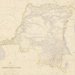
Map of the Congo free state [Document cartographique]
Intelligence Division, War Office, N° 1882
Author(s)
Intelligence Division. War Office
Imprint
[London] : litho[graphe]d at the War Office, October 1904 ; 1904
Publisher
Intelligence Division. War Office
Language
English
Country
United Kingdom
Collation
1 carte : en couleur ; 58 x 57,5 cm
Statement of scale
1:4 000 000
Note
Au bas de la carte: "Agents for the sale of maps published by the Intelligence Division, War Office: London : Edward Stanford ; Edinburgh : John Menzies & Co. ; Dublin : Hodges, Figgis & Co. ; Liverpool : Philip. Son & Nephew ; Manchester : J.E. Cornish & Co.; Glasgow : John Menzies & Co. ; Aldershot : Gale & Polden"
Légende
Content type
text
Carrier type
volume
Digitised version
https://uurl.kbr.be/1848688
Subject(s)
ISBD
See ISBD format
Map of the Congo free state [Document cartographique] / Intelligence Division, War Office, N° 1882. - [London] : litho[graphe]d at the War Office, October 1904 ; 1904. - 1 carte : en couleur ; 58 x 57,5 cm. - Au bas de la carte: "Agents for the sale of maps published by the Intelligence Division, War Office: London : Edward Stanford ; Edinburgh : John Menzies & Co. ; Dublin : Hodges, Figgis & Co. ; Liverpool : Philip. Son & Nephew ; Manchester : J.E. Cornish & Co.; Glasgow : John Menzies & Co. ; Aldershot : Gale & Polden". Légende.


Report an error or problem
Permalink
Checking of available copies ...

Consult online

Request item

Checking of available copies ...
Loading enrichments...